Weather Alert in Oklahoma
Flood Advisory issued August 28 at 2:28AM CDT until August 30 at 7:00AM CDT by NWS Norman OK
AREAS AFFECTED: Grant, OK; Kay, OK
DESCRIPTION: ...The National Weather Service in Norman has issued a Flood Advisory for the following rivers in Oklahoma... Salt Fork Arkansas River near Alva affecting Woods and Alfalfa Counties. Chikaskia River near Blackwell affecting Kay and Grant Counties. Cimarron River near Dover affecting Kingfisher and Logan Counties. * WHAT...Flooding caused by excessive rainfall is expected. * WHERE...Chikaskia River near Blackwell. * WHEN...From early this morning to Saturday morning. * IMPACTS...At 28.0 feet, Low-lying streets may experience nuisance flooding in the northeastern portions of Blackwell. Farmlands and local roads in extreme northeastern Grant and Kay counties may be under shallow water depths for a few hours. Southeast of blackwell... Hubbard Road may be briefly covered by shallow depths of water near the river. * ADDITIONAL DETAILS... - At 1:30 AM CDT Thursday the stage was 2.7 feet. - Bankfull stage is 28.0 feet. - Forecast...The Chikaskia River is expected to rise to a crest of 27.9 feet early tomorrow afternoon. - Action stage is 26.0 feet. - Flood stage is 29.0 feet. - http://www.weather.gov/safety/flood
INSTRUCTION: If you encounter a flooded roadway, turn around and find an alternative route. Additional information is available at www.weather.gov.
Want more detail? Get the Complete 7 Day and Night Detailed Forecast!
Current U.S. National Radar--Current
The Current National Weather Radar is shown below with a UTC Time (subtract 5 hours from UTC to get Eastern Time).

National Weather Forecast--Current
The Current National Weather Forecast and National Weather Map are shown below.

National Weather Forecast for Tomorrow
Tomorrow National Weather Forecast and Tomorrow National Weather Map are show below.

North America Water Vapor (Moisture)
This map shows recent moisture content over North America. Bright and colored areas show high moisture (ie, clouds); brown indicates very little moisture present; black indicates no moisture.

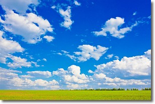
Weather Topic: What are Cumulus Clouds?
Home - Education - Cloud Types - Cumulus Clouds
 Next Topic: Drizzle
Cumulus clouds are fluffy and textured with rounded tops, and
may have flat bottoms. The border of a cumulus cloud
is clearly defined, and can have the appearance of cotton or cauliflower.
Cumulus clouds form at low altitudes (rarely above 2 km) but can grow very tall,
becoming cumulus congestus and possibly the even taller cumulonimbus clouds.
When cumulus clouds become taller, they have a greater chance of producing precipitation.
Next Topic: Drizzle
Weather Topic: What is Evaporation?
Home - Education - Precipitation - Evaporation
 Next Topic: Fog
Evaporation is the process which returns water from the earth
back to the atmosphere, and is another crucial process in the water cycle.
Evaporation is the transformation of liquid into gas, and it happens because
molecules are excited by the application of energy and turn into vapor.
In order for water to evaporate it has to be on the surface of a body of water.
Next Topic: Fog
Current conditions powered by WeatherAPI.com


