Weather Alert in Washington
Red Flag Warning issued August 27 at 1:37PM PDT until August 28 at 9:00PM PDT by NWS Seattle WA
AREAS AFFECTED: West Slopes of the North Cascades Generally above 1500 Feet; West Slopes of the Central Cascades Generally above 1500 Feet; East Portion of the Olympic Mountains
DESCRIPTION: * AFFECTED AREA...Fire Weather Zone 658 West Slopes of the North Cascades Generally above 1500 Feet, Fire Weather Zone 659 West Slopes of the Central Cascades Generally above 1500 Feet and Fire Weather Zone 661 East Portion of the Olympic Mountains. * THUNDERSTORMS...Thunderstorms are favored along the eastern slopes of the Olympic mountains and more so in the Cascades from this afternoon and evening and again Thursday into Thursday night. Some brief heavy rain or isolated wetting rains are possible, but lightning strikes on very dry fuel are capable of new fire starts. * OUTFLOW WINDS...Outflow winds of 25 to 30 mph are possible. Outflow winds can occur ahead of and behind storms and cause erratic wind directions. * IMPACTS...Scattered lightning in dry fuels can cause multiple fire starts. Thunderstorms can also bring sudden sharp wind shifts on existing fires, causing rapid changes in a fire's rate of spread and direction of spread. Thunderstorm outflow winds can be a threat for several hours following the start of a new lightning-caused fire. If a fire were to begin, air quality may diminish in the surrounding area. With lightning occurrences having started Tuesday and thunderstorms expect for two more days, multiple days in a row of lightning strikes on our dry fuels could result in a critical number of new wildfires. * THUNDERSTORMS...Multiple lightning strikes occurred in the higher terrain of the Cascades mountains yesterday afternoon and evening and that will resume this afternoon and evening. Multiple days in a row of lightning strikes on our dry fuels could result in a critical number of new wildfires.
INSTRUCTION: A Red Flag Warning means that critical fire weather conditions are either imminent or occurring now. Any fires that develop will likely spread quickly. Outdoor burning is not recommended.
Want more detail? Get the Complete 7 Day and Night Detailed Forecast!
Current U.S. National Radar--Current
The Current National Weather Radar is shown below with a UTC Time (subtract 5 hours from UTC to get Eastern Time).

National Weather Forecast--Current
The Current National Weather Forecast and National Weather Map are shown below.

National Weather Forecast for Tomorrow
Tomorrow National Weather Forecast and Tomorrow National Weather Map are show below.

North America Water Vapor (Moisture)
This map shows recent moisture content over North America. Bright and colored areas show high moisture (ie, clouds); brown indicates very little moisture present; black indicates no moisture.

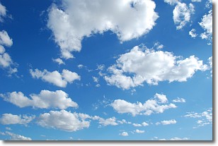
Weather Topic: What are Cumulonimbus Clouds?
Home - Education - Cloud Types - Cumulonimbus Clouds
 Next Topic: Cumulus Clouds
The final form taken by a growing cumulus cloud is the
cumulonimbus cloud, which is very tall and dense.
The tower of a cumulonimbus cloud can soar 23 km into the atmosphere, although
most commonly they stop growing at an altitude of 6 km.
Even small cumulonimbus clouds appear very large in comparison to other cloud types.
They can signal the approach of stormy weather, such as thunderstorms or blizzards.
Next Topic: Cumulus Clouds
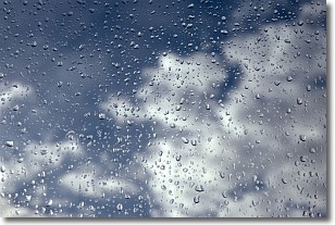
Weather Topic: What is Drizzle?
Home - Education - Precipitation - Drizzle
 Next Topic: Evaporation
Drizzle is precipitation in the form of water droplets which are
smaller than raindrops.
Drizzle is characterized by fine, gently falling droplets and typically does not
impact human habitation in a negative way. The exception to this is freezing drizzle,
a condition where drizzle freezes immediately upon reaching earth's surface.
Freezing drizzle is still less dangerous than freezing rain, but can
potentially result in hazardous road conditions.
Next Topic: Evaporation
Current conditions powered by WeatherAPI.com


