Weather Alert in Alaska
Special Weather Statement issued August 27 at 1:39PM AKDT by NWS Anchorage AK
AREAS AFFECTED: Lower Matanuska Valley
DESCRIPTION: A frontal system moving into Southcentral will usher strong and gusty winds into the Matanuska Valley starting late on Thursday morning, including in and around the Alaska State Fairgrounds. The strongest wind gusts will range from around 30 mph to near 50 mph, with the strongest gusts focused near Palmer and Butte during the afternoon hours on Thursday. Winds will begin to diminish by late Thursday evening into early Friday morning as the front pushes to the east. People are urged to secure loose objects that could be blown around by the strong winds and use caution while traveling. Winds could coincide with periods of moderate rain, potentially making driving difficult at times. Trees are still fully leafed and will be unusually vulnerable to damage from the strong winds. Localized power outages will be possible due the potential for strong winds to bring down tree branches onto power lines.
INSTRUCTION: N/A
Want more detail? Get the Complete 7 Day and Night Detailed Forecast!
Current U.S. National Radar--Current
The Current National Weather Radar is shown below with a UTC Time (subtract 5 hours from UTC to get Eastern Time).

National Weather Forecast--Current
The Current National Weather Forecast and National Weather Map are shown below.

National Weather Forecast for Tomorrow
Tomorrow National Weather Forecast and Tomorrow National Weather Map are show below.

North America Water Vapor (Moisture)
This map shows recent moisture content over North America. Bright and colored areas show high moisture (ie, clouds); brown indicates very little moisture present; black indicates no moisture.

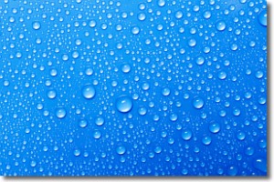
Weather Topic: What is Evaporation?
Home - Education - Precipitation - Evaporation
 Next Topic: Fog
Evaporation is the process which returns water from the earth
back to the atmosphere, and is another crucial process in the water cycle.
Evaporation is the transformation of liquid into gas, and it happens because
molecules are excited by the application of energy and turn into vapor.
In order for water to evaporate it has to be on the surface of a body of water.
Next Topic: Fog
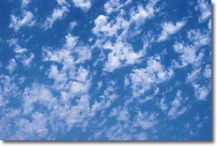
Weather Topic: What are Fractus Clouds?
Home - Education - Cloud Types - Fractus Clouds
 Next Topic: Freezing Rain
A fractus cloud (scud) is a fragmented, tattered cloud which has
likely been sheared off of another cloud. They are accessory clouds, meaning they
develop from parent clouds, and are named in a way which describes the original
cloud which contained them.
Fractus clouds which have originated from cumulus clouds are referred to as
cumulus fractus, while fractus clouds which have originated from stratus clouds
are referred to as stratus fractus. Under certain conditions a fractus cloud might
merge with another cloud, or develop into a cumulus cloud, but usually a
fractus cloud seen by itself will dissipate rapidly.
They are often observed on the leading and trailing edges of storm clouds,
and are a display of wind activity.
Next Topic: Freezing Rain
Current conditions powered by WeatherAPI.com


