Weather Alert in Arizona
Flash Flood Warning issued August 26 at 2:44PM MST until August 26 at 6:45PM MST by NWS Flagstaff AZ
AREAS AFFECTED: Coconino, AZ
DESCRIPTION: FFWFGZ The National Weather Service in Flagstaff has issued a * Flash Flood Warning for... Northern Coconino County in north central Arizona... * Until 645 PM MST /745 PM MDT/. * At 244 PM MST /344 PM MDT/, Doppler radar indicated thunderstorms producing heavy rain across the warned area. Flash flooding is ongoing or expected to begin shortly. HAZARD...Life-threatening flash flooding. Thunderstorms producing flash flooding. SOURCE...Radar. IMPACT...Life-threatening flash flooding of low-water crossings, creeks, normally dry washes and roads. * Some locations that will experience flash flooding include... Paria Canyon, Lee's Ferry CG, Paria Beach, Lee's Ferry, Lees Ferry, Paria River Slot Canyon, Glen Canyon National Recreation Area, Grand Canyon National Park and Navajo Reservation. This includes the following creeks, washes and rivers... Colorado River and Paria River.
INSTRUCTION: Turn around, don't drown when encountering flooded roads. Most flood deaths occur in vehicles. Remain alert for flooding even in locations not receiving rain. Normally dry washes, slot canyons and creeks can become raging killer currents in a matter of minutes, even from distant rainfall.
Want more detail? Get the Complete 7 Day and Night Detailed Forecast!
Current U.S. National Radar--Current
The Current National Weather Radar is shown below with a UTC Time (subtract 5 hours from UTC to get Eastern Time).

National Weather Forecast--Current
The Current National Weather Forecast and National Weather Map are shown below.

National Weather Forecast for Tomorrow
Tomorrow National Weather Forecast and Tomorrow National Weather Map are show below.

North America Water Vapor (Moisture)
This map shows recent moisture content over North America. Bright and colored areas show high moisture (ie, clouds); brown indicates very little moisture present; black indicates no moisture.

Weather Topic: What is Drizzle?
Home - Education - Precipitation - Drizzle
 Next Topic: Evaporation
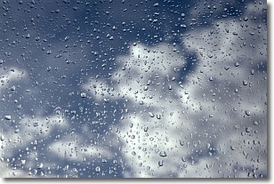
Drizzle is precipitation in the form of water droplets which are
smaller than raindrops.
Drizzle is characterized by fine, gently falling droplets and typically does not
impact human habitation in a negative way. The exception to this is freezing drizzle,
a condition where drizzle freezes immediately upon reaching earth's surface.
Freezing drizzle is still less dangerous than freezing rain, but can
potentially result in hazardous road conditions.
Next Topic: Evaporation
Weather Topic: What is Fog?
Home - Education - Cloud Types - Fog
 Next Topic: Fractus Clouds
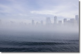
Fog is technically a type of stratus cloud, which lies along the
ground and obscures visibility.
It is usually created when humidity in the air condenses into tiny water droplets.
Because of this, some places are more prone to foggy weather, such as regions
close to a body of water.
Fog is similar to mist; both are the appearance of water droplets suspended in
the air, but fog is the term applied to the condition when visibility is less than 1 km.
Next Topic: Fractus Clouds
Current conditions powered by WeatherAPI.com


