Weather Alert in Arizona
Flash Flood Warning issued August 26 at 1:31PM PDT until August 26 at 4:30PM PDT by NWS Las Vegas NV
AREAS AFFECTED: Mohave, AZ
DESCRIPTION: FFWVEF The National Weather Service in Las Vegas has issued a * Flash Flood Warning for... Central Mohave County in northwestern Arizona... * Until 430 PM MST. * At 131 PM MST, Doppler radar indicated thunderstorms producing heavy rain across the warned area. Flash flooding is ongoing or expected to begin shortly. HAZARD...Life-threatening flash flooding. Thunderstorms producing flash flooding. SOURCE...Radar. IMPACT...Life-threatening flash flooding of low-water crossings, creeks, normally dry washes and roads, especially Blake Ranch Road and DW Ranch Road. * Some locations that will experience flash flooding include... Kingman, Hualapai Mountain Park, Dw Ranch Road, Wild Cow Campground, Blake Ranch Road and Hualapai Peak.
INSTRUCTION: Be aware of your surroundings and do not drive on flooded roads.
Want more detail? Get the Complete 7 Day and Night Detailed Forecast!
Current U.S. National Radar--Current
The Current National Weather Radar is shown below with a UTC Time (subtract 5 hours from UTC to get Eastern Time).

National Weather Forecast--Current
The Current National Weather Forecast and National Weather Map are shown below.

National Weather Forecast for Tomorrow
Tomorrow National Weather Forecast and Tomorrow National Weather Map are show below.

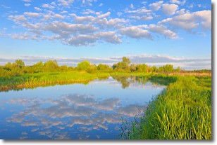
North America Water Vapor (Moisture)
This map shows recent moisture content over North America. Bright and colored areas show high moisture (ie, clouds); brown indicates very little moisture present; black indicates no moisture.

Weather Topic: What are Stratocumulus Clouds?
Home - Education - Cloud Types - Stratocumulus Clouds
 Next Topic: Stratus Clouds
Stratocumulus clouds are similar to altocumulus clouds in their
fluffy appearance, but have a slightly darker shade due to their additional mass.
A good way to distinguish the two cloud types is to hold your hand out and measure
the size of an individual cloud; if it is the size of your thumb it is generally
an altocumulus cloud, if it is the size of your hand it is generally a
stratocumulus cloud.
It is uncommon for stratocumulus clouds to produce precipitation, but if they do
it is usually a light rain or snow.
Next Topic: Stratus Clouds
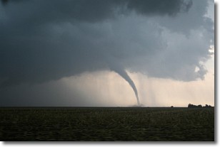
Weather Topic: What are Wall Clouds?
Home - Education - Cloud Types - Wall Clouds
 Next Topic: Altocumulus Clouds
A wall cloud forms underneath the base of a cumulonimbus cloud,
and can be a hotbed for deadly tornadoes.
Wall clouds are formed by air flowing into the cumulonimbus clouds, which can
result in the wall cloud descending from the base of the cumulonimbus cloud, or
rising fractus clouds which join to the base of the storm cloud as the wall cloud
takes shape.
Wall clouds can be very large, and in the Northern Hemisphere they generally
form at the southern edge of cumulonimbus clouds.
Next Topic: Altocumulus Clouds
Current conditions powered by WeatherAPI.com


