Weather Alert in Arizona
Flash Flood Warning issued August 26 at 2:01PM MST until August 26 at 6:00PM MST by NWS Flagstaff AZ
AREAS AFFECTED: Coconino, AZ
DESCRIPTION: FFWFGZ The National Weather Service in Flagstaff has issued a * Flash Flood Warning for... The White Sage in... North Central Coconino County in north central Arizona... * Until 600 PM MST. * At 200 PM MST, Doppler radar indicated thunderstorms producing heavy rain over the White Sage burn scar. Between 1 and 1.5 inches of rain have fallen. Flash flooding is ongoing or expected to begin shortly. HAZARD...Life-threatening flash flooding. Thunderstorms producing flash flooding in and around the White Sage. SOURCE...Radar. IMPACT...Life threatening flash flooding of areas in and around the White Sage. * Some locations that will experience flash flooding include... Condor Viewing Site, House Rock Overlook, House Rock and Le Fevre Overlook. This includes the following creeks, washes and rivers... House Rock Wash, Coyote Wash, Kaibab Wash and Rock Canyon.
INSTRUCTION: Immediately move out of and away from creeks and washes in the White Sage. Flash flooding is occurring or imminent. Turn Around, Don't Drown if you encounter flood waters while driving. Avoid recently burned areas and downstream locations. Life-threatening flooding of creeks, roads and normally dry washes will occur. Rockslides and mudslides will likely occur in steep terrain.
Want more detail? Get the Complete 7 Day and Night Detailed Forecast!
Current U.S. National Radar--Current
The Current National Weather Radar is shown below with a UTC Time (subtract 5 hours from UTC to get Eastern Time).

National Weather Forecast--Current
The Current National Weather Forecast and National Weather Map are shown below.

National Weather Forecast for Tomorrow
Tomorrow National Weather Forecast and Tomorrow National Weather Map are show below.

North America Water Vapor (Moisture)
This map shows recent moisture content over North America. Bright and colored areas show high moisture (ie, clouds); brown indicates very little moisture present; black indicates no moisture.

Weather Topic: What are Cumulonimbus Clouds?
Home - Education - Cloud Types - Cumulonimbus Clouds
 Next Topic: Cumulus Clouds
The final form taken by a growing cumulus cloud is the
cumulonimbus cloud, which is very tall and dense.
The tower of a cumulonimbus cloud can soar 23 km into the atmosphere, although
most commonly they stop growing at an altitude of 6 km.
Even small cumulonimbus clouds appear very large in comparison to other cloud types.
They can signal the approach of stormy weather, such as thunderstorms or blizzards.
Next Topic: Cumulus Clouds
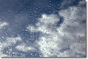
Weather Topic: What is Drizzle?
Home - Education - Precipitation - Drizzle
 Next Topic: Evaporation
Drizzle is precipitation in the form of water droplets which are
smaller than raindrops.
Drizzle is characterized by fine, gently falling droplets and typically does not
impact human habitation in a negative way. The exception to this is freezing drizzle,
a condition where drizzle freezes immediately upon reaching earth's surface.
Freezing drizzle is still less dangerous than freezing rain, but can
potentially result in hazardous road conditions.
Next Topic: Evaporation
Current conditions powered by WeatherAPI.com


