Weather Alert in Alaska
High Wind Warning issued August 27 at 1:11PM AKDT until August 28 at 10:00PM AKDT by NWS Anchorage AK
AREAS AFFECTED: Anchorage
DESCRIPTION: * WHAT...Southeast winds 20 to 30 mph with gusts up to 55 mph expected. * WHERE...Anchorage. * WHEN...From 8 AM to 10 PM AKDT Thursday. * IMPACTS...High winds may move loose debris, damage property, and cause power outages. Trees are still fully leafed, and will be particularly vulnerable to damage in strong winds. Travel could be difficult, especially for high profile vehicles. * ADDITIONAL DETAILS...A frontal system will move into Southcentral on Thursday and bring widespread strong winds to the Anchorage Bowl starting late Thursday morning. The stronger winds will initially be confined to the east side of town, then rapidly spread to the rest of Anchorage late on Thursday morning. The strongest wind gusts ranging from 35 to 55 mph are expected to peak early Thursday afternoon. Winds will then slowly diminish through Thursday evening.
INSTRUCTION: People are urged to secure loose objects that could be blown around or damaged by the wind. Prepare for the possibility of widespread power outages. Use caution if you must drive.
Want more detail? Get the Complete 7 Day and Night Detailed Forecast!
Current U.S. National Radar--Current
The Current National Weather Radar is shown below with a UTC Time (subtract 5 hours from UTC to get Eastern Time).

National Weather Forecast--Current
The Current National Weather Forecast and National Weather Map are shown below.

National Weather Forecast for Tomorrow
Tomorrow National Weather Forecast and Tomorrow National Weather Map are show below.

North America Water Vapor (Moisture)
This map shows recent moisture content over North America. Bright and colored areas show high moisture (ie, clouds); brown indicates very little moisture present; black indicates no moisture.

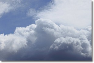
Weather Topic: What are Nimbostratus Clouds?
Home - Education - Cloud Types - Nimbostratus Clouds
 Next Topic: Precipitation
A nimbostratus cloud is similar to a stratus cloud in its formless,
smooth appearance. However, a nimbostratus cloud is darker than a stratus cloud,
because it is thicker.
Unlike a stratus cloud, a nimbostratus cloud typically brings with it the threat
of moderate to heavy precipitation. In some cases, the precipitation may evaporate
before reaching the ground, a phenomenon known as virga.
Next Topic: Precipitation
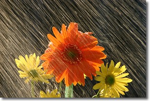
Weather Topic: What is Rain?
Home - Education - Precipitation - Rain
 Next Topic: Shelf Clouds
Precipitation in the form of water droplets is called rain.
Rain generally has a tendency to fall with less intensity over a greater period
of time, and when rainfall is more severe it is usually less sustained.
Rain is the most common form of precipitation and happens with greater frequency
depending on the season and regional influences. Cities have been shown to have
an observable effect on rainfall, due to an effect called the urban heat island.
Compared to upwind, monthly rainfall between twenty and forty miles downwind of
cities is 30% greater.
Next Topic: Shelf Clouds
Current conditions powered by WeatherAPI.com


